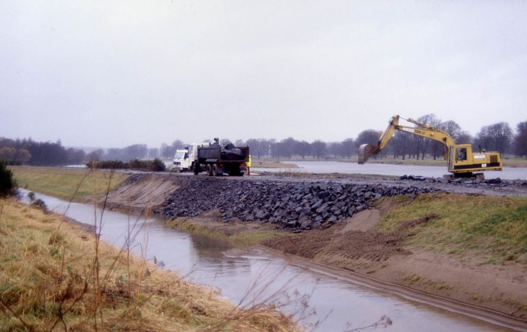
How do we Measure That…

It was 9:55am and, scrolling through my emails, one particular message from Dr Andrew Black caught my attention: ‘Fieldwork Help Required Today’. It didn’t take me long to hit reply…

>1 m standing waves dowstream of Pony Bridge.

Two hours later Finlay and I were driving north on the A9 as quickly as legally possible in our tiny rental car, an ADCP (Acoustic Doppler Current Profiler) jammed in the back seats. The aim of our mission was to quantify the exceptionally high flows occurring on the River Feshie, caused by rapid melt of the snowpack (~40 mm rainfall equivalent) which fell 3 days earlier during Storm Deirdre. We followed the Spey into the Cairngorms. In some places its swirling water had overtopped the banks and here and there a couple of sheep could be seen standing marooned by floodwaters.

SEPA had estimated peak flows of 107 cumecs at their Feshie Bridge gauging station and, as we drove up into Glen Feshie, it became apparent that, if anything, their estimation was conservative. Murky water roared down the glen, tugging at vegetation and cutting into the river banks. We stood uneasily on the Pony Bridge, the standing waves downstream over a metre high! Upstream, fresh erosion could be seen on the high outside banks of the meander and, as we tied ropes to the ADCP, a tree shot past, borne along by the floodwaters.  Neither Finlay or I had ever attempted to gauge flows in conditions quite like this and soon found out first hand just how much power water has.

Big boat, little car.
Preparing the ADCP for launch.

The ADCP emits sound waves and utilises the doppler effect to capture the flow velocities throughout the water column and generate a profile of the river bed. The device must be dragged across the width of the river to obtain a reading and, equipped with several lengths of orange rope, we stationed ourselves on opposite banks. However, with the ADCP in the water, it very quickly became apparent that pulling it across in such high flows was going to be difficult and we hauled it in before it could be swept downstream. Slightly upstream, we found a wider section of river with lower flow velocities.

Ropes at the ready.

However, keeping the long ropes out of the water proved impossible and, once the river had hold of them, it wouldn’t let go! No matter how hard we pulled, the ropes stayed put and gradually slipped through our hands and further downstream! Eventually Finlay waved his arms… it was no use. I let go and, with a snap, the rope leapt from the bank and vanished downstream (it was thankfully tied to a tree on the other bank). At this stage we admitted defeat and packed up our kit. The SEPA gauge downstream at Feshie Bridge had recorded a peak flow of 141 cumecs.

High water under the bridge.


It was an opportunity missed and, in hindsight, there may have been other ways to get the data we were after. Although significantly less high tech, we could have played Poohsticks with twigs, timing their journey down a measured section of river to estimate water velocities across the channel. A river bed profile could then have been obtained another day in more benign conditions. However, now that river levels have fallen again, debris lines left behind by the flood could perhaps be mapped to reconstruct what was going on in the river that afternoon.

Remembering the Great Tay Flood of January 1993

25 years ago, on 17 January 1993, a peak river flow of 2268 m3/s was recorded at Ballathie gauging station on the River Tay – the highest rate ever recorded in the UK.  At the time, I had only just started work for the National River Flow Archive at the NERC Institute of Hydrology.  The flood left hundreds of people with devastated homes and many lasting impacts: the memory is perhaps best forgotten for many of them.  For me, it was a key moment at the start of a hydrological career in Scotland, and there’s been no lack of interesting projects to investigate since.

Reflecting on the Great Tay Flood, it’s worth taking a moment to think about how much has changed since then.  Many of these changes may be partly attributable to that fateful event in Perthshire: it changed how we thought about flood risk in Scotland at least.  Here are some quick personal reflections:

Climate change was much more of a contentious issue back then – could human agency really be changing the climate?  There was a sense that this was a flood (reckoned to be the biggest in almost 200 years) that shouldn’t have happened: something must have gone wrong to cause such a disaster.  Some looked to climate change as “the reason”.  I remain uncomfortable with the idea of attributing a single large flood solely to climate change, but I think the vast majority of hydrologists would see it as being of critical importance to flood risk assessment in general.  It’s one of the key hydrological challenges for the future.

Sodden house contents after the flood

Flood forecasting and warning were in their infancy then.  Certainly, the hydrologists of the day were using all the information at their disposal; it was clear to them that something very big was about to happen, and that information was shared with the authorities who needed the best information available.  Telemetry monitoring systems, the science behind flood forecasting and the methods of issuing warning messages and preparing recipients have been transformed in the years since – see the Scottish Flood Forecasting Service. and Scottish Flood Forum.  I’m not sure if community resilience had entered many people’s vocabularies back then…?

Dalguise
Washed-out railway embankment at Dalguise in the Tay valley

Perth got its flood defences, completed in 2001, at a cost of £25 million – the most costly scheme in Scotland at the time.  At 8km long, the design allowed for subsequent raising if the need were to arise: a recognition of the uncertainty of risk estimation and the possible effects of climate change.  The defences incorporated more than 80 gates, to address local needs for access, and relying for their operation on the growing capabilities of flood warning.  The scheme provides structural protection for many hundreds of homes and businesses, and a good deal of peace of mind for those at risk.

Perth flood defences under construction, Tay Street

It’s worth thinking about the role played by the flood marks on Smeaton’s Bridge.  The marks showed that 1993 was the highest flood since the bridge was built in the 1770s – excluding the 1814 ‘ice jam’ flood.  And that was an outlier – we don’t get ice jam floods any more: nobody was arguing that we should allow for that scenario in future.  So the historic record provided a context for the flood: it gave some certainty that this flood really was something unprecedented.

Also since 1993, legislation has seen the responsibilities for flood risk management overhauled, most recently in the 2009 Flood Risk Management (Scotland) Act, with the roles of local authorities and SEPA (formed in 1996) in particular clarified, extended and better coordinated.

What else has changed or happened? Scottish devolution, the economic downturn of 2008, ubiquitous smartphones!  These are just a few thoughts as we pass this anniversary.  Maybe you’d like to share your thoughts?