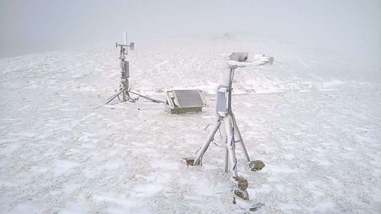
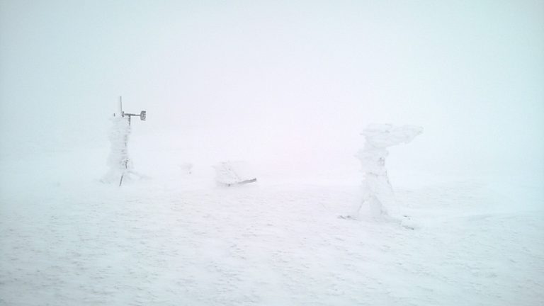
Sometimes, environmental monitoring just has to be a team effort

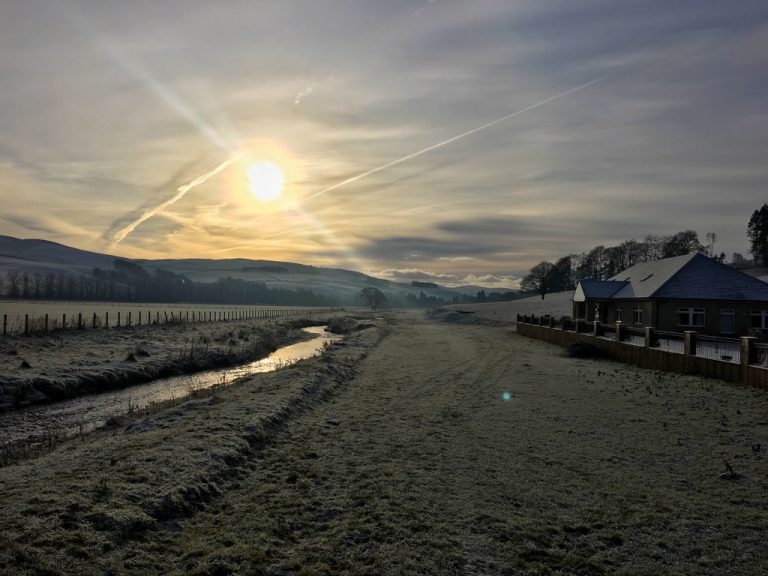
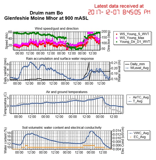
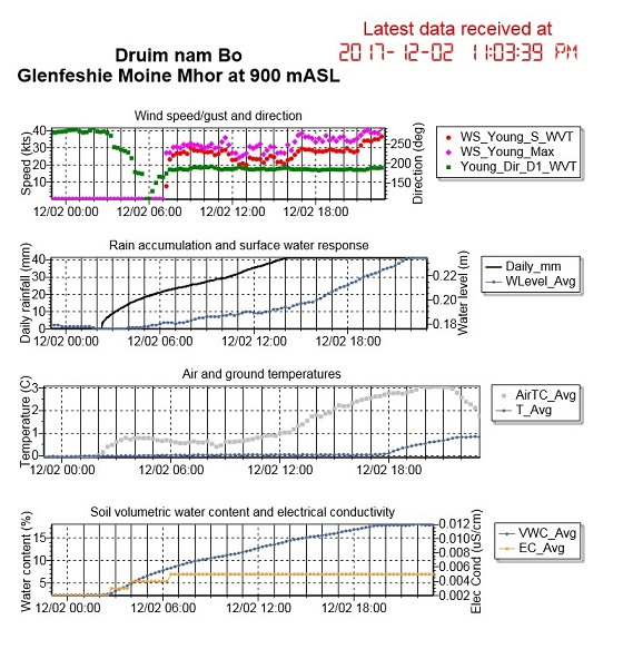
Upgrading of the power supply required a field visit last Friday, in the interests of maintaining data completeness.  Fortunately, Wildland as site owners have the logistical capabilities to deliver results.

SBS500 recording rain gauge

Visiting during wintry conditions allows processes to be observed at first hand: the icing on the equipment will surely affect recorded precipitation amounts when melt occurs (24.4 mm recorded over 3 hours on Sunday 17th); it was also an opportunity to clear the sensors.  Impressively, the R M Young wind speed & direction sensor was still operating correctly!

When only serious logistics will do!

Many thanks to Sam and Ivan for invaluable help on the day.

Chilly for flow gauging

It was minus 10 C when our Eddleston field hydrometrist Boyd set off for his work this morning – but the work must go on!  Indeed some flow meters might not cope with such temperatures, but our Flow Tracker – and Boyd – seem able to cope with the conditions.  Low temperature gaugings let us keep check on ratings when ice/snow build-up may affect channel conditions and water levels.

Extreme conditions often produce the most memorable photos – so glad there was some added benefit arising from your determined efforts, Boyd!  I am happy to confirm it was very warm in my office this morning 🙂

Storm Caroline brings in the changes to Glen Feshie

Maximum wind speeds at the Wildland Mountain Observatory reached 70.5 mph this morning (31.49 m/s) as Storm Caroline brought high winds and property damage to many parts of northern Britain. Temperatures at 900 m OD fell from a balmy 7.0 C at 0130 GMT to -0.8 C three hours later, and down to -4.8 C at 2045 GMT.  This brought to an end 3+ days of continuous snowmelt from all elevations across the catchment: a 10 mm rainfall at high altitude caused a brief further rise in the river, followed by a fall to levels quickly below the snowmelt levels of the past few days.  Heavy snow is now forecast for all levels, so the river looks set to continue falling for some days.  Disdrometer data from Druim nam Bo show snowflake diameters in excess of 8 mm.

Feshie Bridge hydrograph 4-7 Dec 2017. Source: SEPA

Note for comparison: the Cairngorm AWS recorded a maximum gust speed in the order of 120 mph at an altitude of 1245 m OD.  The ridge location of the Druim nam Bo AWS may limit wind speeds there in comparison to the smoother, broader Cairngorm summit.

Uncovering the secrets of the environmental past – you can help!

Weather Rescue project is seeking volunteer citizen scientists to bring historic weather observations into the reach of digital science. Millions of meteorological observations are waiting for volunteers to enter them into digital format, and so make then accessible for climate research.  And of course where improvements in climate research take place, there’s scope to improve hydrological understanding too – not least extremes of wet and dry.  See the feature article and the link to the project here on BBC news.

Post your comments here if you’d like to share your efforts as part of a Dundee team effort.

Monitoring mountain precipitation – difficulties in practice

Power availability is the big challenge at 900 m elevation.  The Wildland mountain observatory on Druim nam Bo benefits from a 60 W solar panel and a wind turbine generator, with 220 Ah of battery capacity.

Ben Pickering’s disdrometer, pictured here in the foreground, needs 1 Amp of current, so sometimes there isn’t enough to go around (for long).  A low voltage disconnect (LVD) stops the power to the disdrometer when reserves get too low – leading to this icing-up spectacle on 19th November – while the weather station continues unabated.  Since then, conditions have improved, so hopefully laser radiation is once again analyzing the precipitation – solid and liquid – as it falls.  Latest data are here.

Big thaw at the weekend

After 10 days of continually freezing conditions at the Wildland mountain observatory on Druim nam Bo, warm air on Saturday brought a thaw to high altitudes – and significant melt.  Some 41.2 mm of snowmelt was recorded through the rain gauge.  The ground had been frozen and gradually climbed above zero – escaping from freezing some 16 hours after the air temperature.

Water level in the adjacent pond rose some 5 cm, soil moisture content rose from 2% to 18% – though the initially low value may be a reflection of freezing conditions.  The rise in pond level began 2 hours after thaw began to be recorded by the rain gauge.