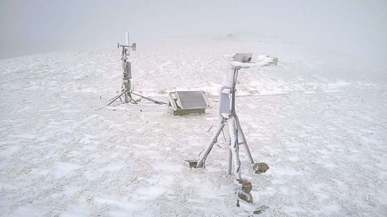
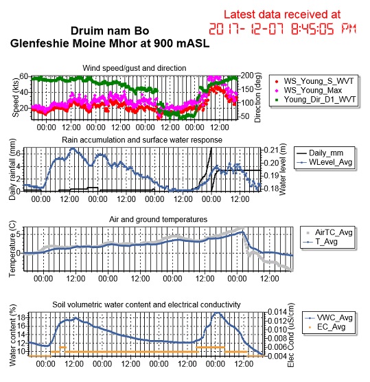
Storm Caroline brings in the changes to Glen Feshie

Maximum wind speeds at the Wildland Mountain Observatory reached 70.5 mph this morning (31.49 m/s) as Storm Caroline brought high winds and property damage to many parts of northern Britain. Temperatures at 900 m OD fell from a balmy 7.0 C at 0130 GMT to -0.8 C three hours later, and down to -4.8 C at 2045 GMT.  This brought to an end 3+ days of continuous snowmelt from all elevations across the catchment: a 10 mm rainfall at high altitude caused a brief further rise in the river, followed by a fall to levels quickly below the snowmelt levels of the past few days.  Heavy snow is now forecast for all levels, so the river looks set to continue falling for some days.  Disdrometer data from Druim nam Bo show snowflake diameters in excess of 8 mm.

Feshie Bridge hydrograph 4-7 Dec 2017. Source: SEPA

Note for comparison: the Cairngorm AWS recorded a maximum gust speed in the order of 120 mph at an altitude of 1245 m OD.  The ridge location of the Druim nam Bo AWS may limit wind speeds there in comparison to the smoother, broader Cairngorm summit.

Monitoring mountain precipitation – difficulties in practice

Power availability is the big challenge at 900 m elevation.  The Wildland mountain observatory on Druim nam Bo benefits from a 60 W solar panel and a wind turbine generator, with 220 Ah of battery capacity.

Ben Pickering’s disdrometer, pictured here in the foreground, needs 1 Amp of current, so sometimes there isn’t enough to go around (for long).  A low voltage disconnect (LVD) stops the power to the disdrometer when reserves get too low – leading to this icing-up spectacle on 19th November – while the weather station continues unabated.  Since then, conditions have improved, so hopefully laser radiation is once again analyzing the precipitation – solid and liquid – as it falls.  Latest data are here.